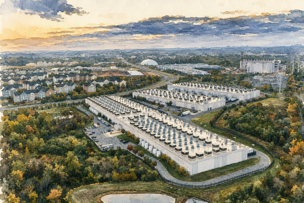
Yesterday evening, I had the pleasure of participating in a panel discussion on Clubhouse, hosted by Todd Barr and Jordan Cullen, and including Will Cadell of SparkGeo. Clubhouse seems to be a really convenient venue for setting up such a forum with low barriers to entry, so that was enjoyable. The topic of the discussion…
Category: geospatial
Ask the Right Questions
If you’re about to embark on a requirements drill or needs assessment focused on “web GIS,” it is important to be sure to answer one question as you proceed: Do you actually need any specialized mapping server at all? If “none” isn’t one of the choices in your analysis of alternatives, then you are doing…
File Geodatabase Schema Compare Tool
In my work supporting various aspects of geospatial data modeling, I’ve spent a lot of time delving into concepts around configuration management of such data models. We’ve been able to apply a core tool set to perform various functions such as version managment, profiling, version-to-version migration, and validation in conjunction with a system we call…
GeoJSON From ArcGIS Server
A while back, I posted about my desire to see GeoJSON supported as an output format from ArcGIS Server. I found myself needing that capability so I recently completed, and posted to GitHub, a first cut at a server object extension (SOE) for ArcGIS Server 10.1 that enables output of GeoJSON via an HTTP GET….
OGC Abandons the Web
Those are my words, not theirs. It came to light today that OGC has decided to withdraw the GeoServices REST Specification, also known as the “ESRI REST API,” as a proposed standard. I will not take up the relative merits of the specification or the implications of OGC potentially adopting an industry-developed specification that has…
Open-Source GIS Bootcamp at Salisbury University
Thanks to LinkedIn, I saw that Dr. Art Lembo of Salisbury (Maryland) University is leading an “Open Source/Enterprise GIS Summer Bootcamp” at the university from June 3 – 7, 2013. All of the salient details, including contact information, can be found here (PDF).
Simple Tile Viewer
We do a lot of tiles for various customers at Zekiah. Tiling is as much art as science and sometimes things go wrong so we have a range of utilities that we use to perform various kids of QA. Because the caches can be large, we usually want to perform a visual QA on the…
When Is a GeoPortal Not a GeoPortal?
When it’s really a desktop application. Over the past few weeks, I have been reading with conflicted agreement the posts of Brian Timoney and Bill Morris about the nature of geo-portals and what they should or should not be and do. I say that I am in conflicted agreement not because I take any issue…
SharpMap 1.0 RC1 Released
Over on Google+, Diego Guidi let me know that the SharpMap 1.0 Release Candidate has been released. There was a time when I worked with, and wrote about, SharpMap a lot. During that entire time, the stable version of SharpMap sat at some version number that started with “0.9”. The release of a 1.0 candidate…
Early Bird Registration for FOSS4G-NA Closes Soon
David Bitner sent out a reminder that Early Bird reagistration for the FOSS4G North Americaconference closes on 1 April 2013. After that, the price goes up by $50 US. You can register online at EventBrite. The preliminary program (PDF) for this year’s event looks exceptional, building upon and potentially exceeding the outstanding quality of FOSS4G-NA…