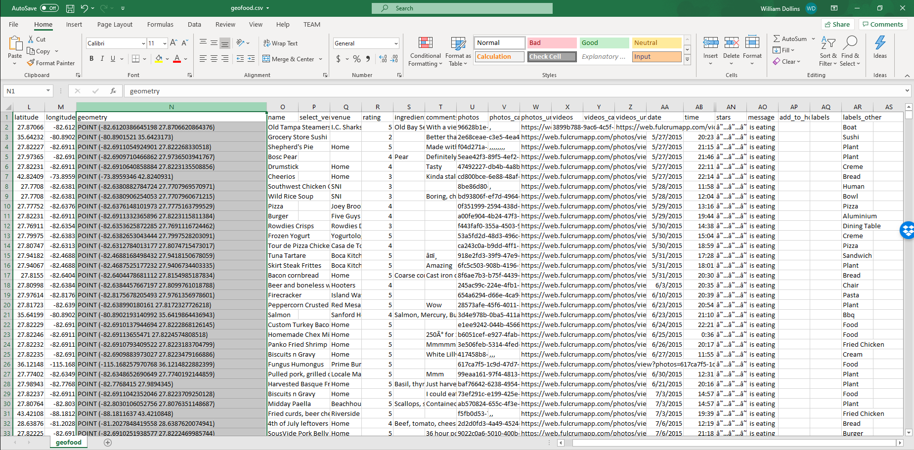
The Best Thing I Saw at TUGIS 2013

I spent the day yesterday at Towson University attending the TUGIS 2013 conference. The new one-day format was a firehose that showcased the diversity of geospatial work occurring across the State of Maryland. The keynote by Learon Dalby was well-received and the content of the conference was generally substantive. While the day was a sprint, there was one workshop that really caught my attention more so than I would have thought from its title.

Read more

Checking Out the GDAL/OGR Plugin for ArcGIS

A while back, I blogged the availability of a GDAL/OGR plug-in for ArcGIS desktop by Ragi Burhum at AmigoCloud. At the time, I was hoping to dig into it fairly quickly but that didn’t happen and I’m finally getting to it. Anyone who has followed this blog for a while knows that I have had more than a passing interest in integrating new data sources with ArcGIS over the years. This comes from the fact that, as a technology geek, I am fascinated by all forms of technology and enjoy the process of integration and, as a consultant providing services to the Federal Government, most of my customers have standardized on Esri tools. Integrations such as GeoRSS, PostGIS, GeoCommons and GeoJSON have directly benefitted my customers for real-world applications so I continue look for ways to remove the barriers between them and the data they seek.

Read more

Put Planet Geospatial to Work for You

I’m happy to see that James has decided keep Planet Geospatial going. It’s been one of the more consistently valuable resources in the community since its inception and it’s good that it will continue.

While I’m looking forward to seeing how James evolves Planet Geospatial, there are ways to more efficiently extract value out of its current state right now. At its core, Planet Geospatial is an RSS feed. RSS can safely be called “venerable” nowadays, but it still does what it does very well.

Two of my favorite tools for culling down the firehose that is Planet Geospatial are IFTTT (the title of this post is a riff on the IFTTT motto) and Evernote. If you’re not familiar with IFTTT, you should be. It reminds me of a more-intuitive Yahoo Pipes and it allows you to mix channels, triggers, and actions to automate processes of your choosing. It’s become by preferred method of synchronizing my blog with social media and for filtering data sources. It also drives the Unofficial QGIS Info Twitter account.

Read more

The Biggest News You May Have Missed…

In case you missed it, this tweet floated across the Twitters last week: Blogged: TileMill Connect – Open Mxd Documents in @mapbox TileMill http://t.co/hDicr4z0 — Arc2Earth (@Arc2Earth) November 15, 2012 Yes, the team at Arc2Earth is apparently working on a new feature in Arc2Earth Sync, called TileMill Connect, that will link ArcMap MXDs with TileMill. … Read more

Personal Geospatial Workflows

I’ve had a couple of people ask me recently about the geospatial tools I use. Year-over-year, that answer changes but here’s how I answer that right now:

As a Federal contractor, I spend a lot of time working with the Esri stack during my work day. A few years ago, I added a few open-source geospatial tools into my tool set and, since then, have also done a respectable amount to consulting work them as well. The balance between the two varies over time, depending on the requirements of individual customers and projects. Lately, commercial customers have seemed much more interested in open-source tools while my government customers are sticking with Esri. Since those observations are based on the the extremely heavy filter of my own recent experience, I’d be hesitant to draw any larger conclusions from them.

I’ve always believed that proficiency with a wide range of tools makes me a better consultant and integrator, so I am always exploring and trying new things. With those commercial customers, and in my own personal side projects, my recent workflows have gelled around a core set of tools, both commercial and open-source:

Read more

Still Jonesing for zigGIS? Try this OGR Plug-In for ArcGIS.

So I’ve actually noticed a surprising uptick in traffic related to zigGIS lately? We also had someone asking about ST-Links on the zigGIS mailing list last week. Clearly, there’s still a level of interest out there for the problem that zigGIS was designed for. ArcGIS reading SpatiaLite natively, thanks to OGR and Ragi Burhum Along … Read more

ToGeoJson and ToWKT for the Esri FGDB API

In support of some of our ongoing PIM work, we’ve been integrating the Esri File Geodatabase (FGDB) API into some tools. Without going into a level of detail that would hijack this post, one of the many functions performed by some of the tools is to validate physical spatial databases against established data models to analyze compliance and identify differences. These databases may be in Esri or non-Esri formats and we have traditionally handled Esri geodatabases through ArcObjects since it provides a relatively uniform interface across the various flavors of geodatabase.

Of course, ArcObjects requires an ArcGIS license of some sort and we are finding out that this is not always available to users in the field under many situations so the FGDB API gets past that for file geodatabases, at least.

Read more

Configuration Management for Geospatial Data Models

I wanted to take a opportunity to do something I don’t often do, and draw attention to a series of posts that’s going on over on my company’s blog. About a year ago, my company, Zekiah Technologies joined forces with Upper 90 Systems. Upper 90 was probably best known for their work building tools that supported the Spatial Data Standard for Facilities, Infrastructure, and Environment (SDSFIE), which is a data model that is used by the US DOD to standardize the representation of GIS data for the purpose of performing facilities management on military installations.

SDSFIE (PDF) has existed for some time, with several versions of the standard being rolled out to its diverse user community. Through that process, we’ve learned a thing or two about configuration management of widely-implemented geospatial data models. This understanding has been turned into a series of tools designed to help with the issues surround lifecycle management of a data model (as opposed to physical databases themselves).

Read more