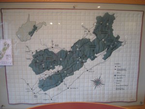
I found this map on display at the Cranberry Glades visitor center in West Virginia (click any of the pictures to enlarge them):
One of the rangers working there told me it is to scale (although the quilt itself lacks any indication of scale).
The next two pictures are close-ups showing the north arrow and the use of buttons as place markers. The kids we are traveling with were fascinated by this map. You will notice a red box over a portion of the forest. That was the area covered by a relief map on a table elsewhere in the visitor center.


As someone who frequently visit the Mon, I really like this map. The Denali one is great too, though I’m not sure I like the pixel effect.
That one is cool, but see this one…
http://www.docstoc.com/docs/653840/Interpreting-Denali-s-Landcover-Types-with-Fabric
I’ve seen this Denali quilt in person, just amazing. About 12×12 feet, landcover with elevation contours even.