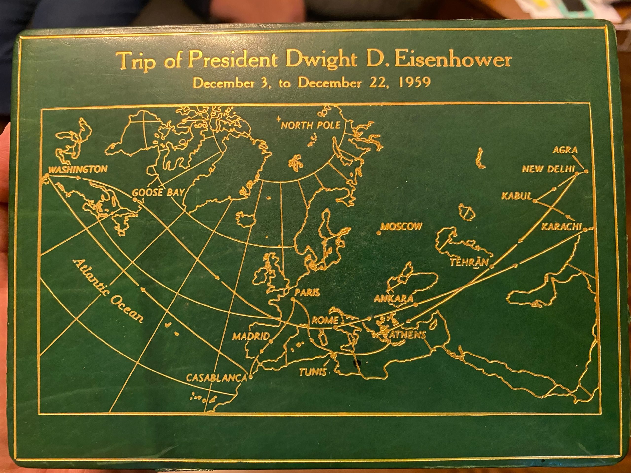
When he was in the Air Force, my father served on Air Force One under four presidents – Eisenhower, Kennedy, Johnson, and Nixon. He was on the engine crew and got to see a lot of the world over the course of those administrations. I grew up with Presidential memorabilia all through our home: signed…
Tag: cartography
A Funny Thing Happened On the Way to a Calendar
The call for maps for the 2017 GeoHipster calendar has closed and review is underway. I haven’t begun collating the responses yet, so I have no idea how it will turn out, but I can say that, for me, the process so far has been personally rewarding. I was not involved in the making of…
Bring Out Your Maps!
It’s time again to get into calendar-making mode. A new call for maps was issued over on GeoHipster for the 2017 calendar. We had a lot of fun last year seeing the creativity from the worldwide geospatial community and we are looking forward to this year’s batch of maps. We also learned a lot from the…
GeoHipster Call for Maps
Earlier this year, I joined the newly-formed advisory board for the web site GeoHipster. The site, and specifically the Q&A interview format with people working throughout the geospatial industry, had rapidly developed an audience and the logistics had outpaced the ability of the site’s founder, Atanas Entchev, to keep up. So a group of us…
Cutting Tiles for ArcGIS Server Using TileMill
There’s been a lot of talk about TileMill and CartoCSS lately, with good cause. TileMill makes it very easy generate beautiful map tiles using the Mapnik engine and CartoCSS provides a familiar method to author the cartographic representation of spatial data. As Brian Timoney points out, CartoCSS has the added bonus of making best practices…